Index
3.1 Project management
Projects are purposeful groupings of an organizations' media and metadata to answer specific questions or implement a study design. Projects can be one of three sensors: ARUs, cameras or point counts. For each of these sensor types, a collection of tasks (ARU), image sets (camera) or surveys (point counts) are processed or uploaded in order retrieve species data.
WildTrax requires at least one administrator per project. Project administrators manage the upload of media, user management and assignments, auditing and species verification, and project publication. Organization administrators create the project and assign a project administrator to manage it. These administrators also add read-only members or share location reports with other WildTrax users
The general life cycle of a project involves:
- Creating a project
- Adding users to the project
- Uploading media or data depending on the sensor
- Creating or uploading tasks or surveys
- Creating (processing) or uploading tags or observations
- Verifying and quality controlling tags
- Publishing the project (All sensors)
-
Choosing a sensor and creating a project
Each processing interface and project dashboard in WildTrax is customized to the sensor type. Depending on the type of media or data you have, you would create a project in the appropriate sensor. Here are some basics steps on how to get started creating a project.
- Create or join an organization. You must create an organization or become an administrator of an organization before creating a project. The Add Project buttons won’t appear on the Project dashboard until this is complete.
- Go to the top ribbon and select
 and then
- Select which sensor you’d like to create a project for. You can jump to the corresponding sections to find out more on how to create and administrate each type of project:

-
Merging projectsYou may need to use environmental sensors across a number of years or for specific questions related to study design. WildTrax offers an unlimited number of projects that can be created at any time in order to cater to this need. However, there are times when these questions and multi-year projects can be unified to collate and make the data more cohesive. WildTrax gives you this ability with the project merging tool.Clicking on the
 beside the project name on the dashboard will also show the
  button. This function allow you to merge a source project to a target project.
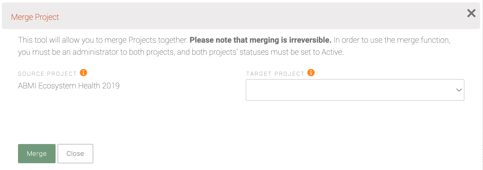
-
Deleting a project
To delete a project, click the drop down arrow next to the editing pencil in the project list, and click the
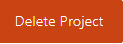 button.
Only projects with no image sets or tasks can be deleted. If you already uploaded data to your project, you will need to delete them prior to deleting your project.
-
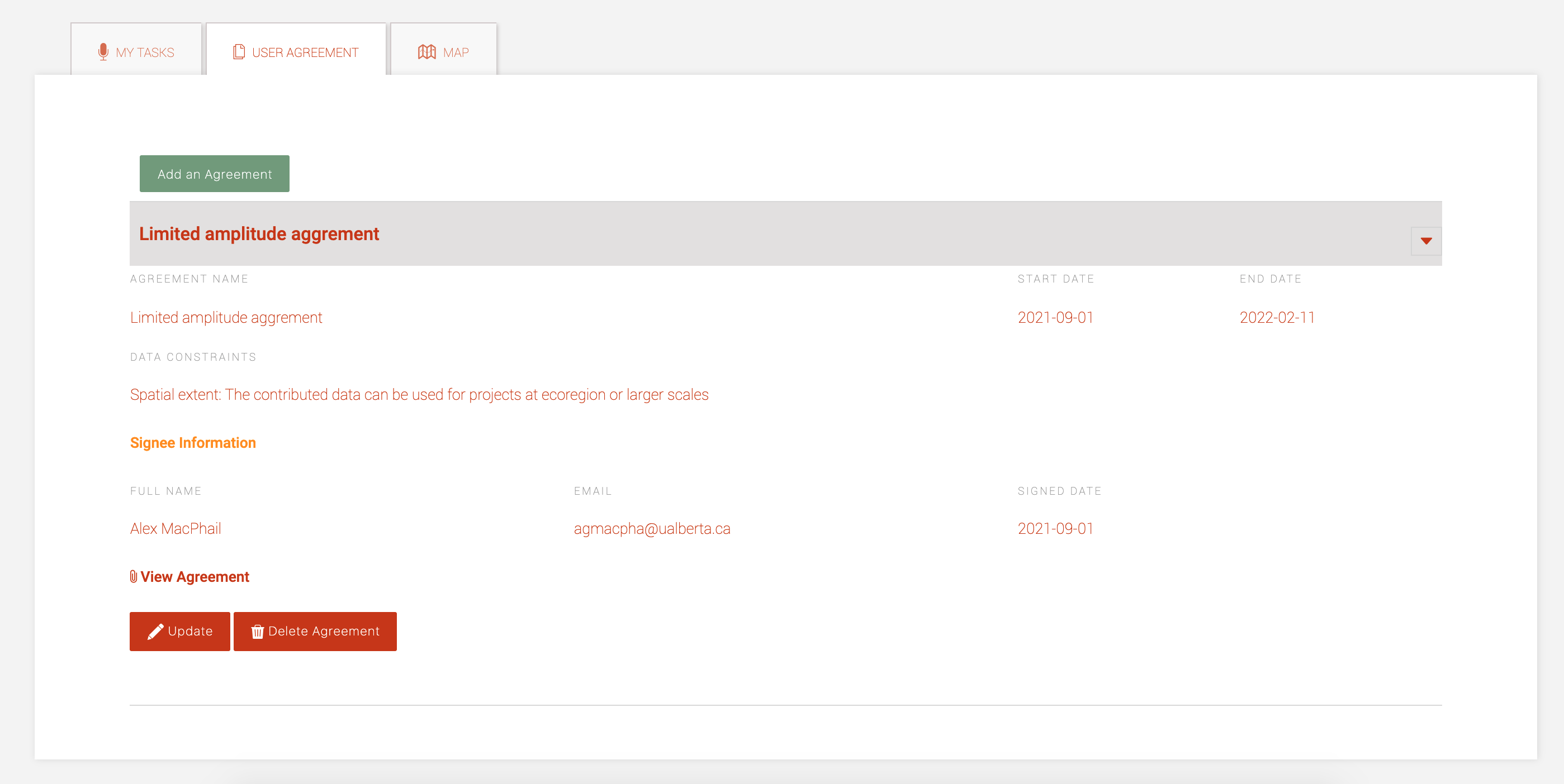
User agreements
The User Agreement tab supports additional information for your project. If you need to append documentation to the project for data sharing agreements you can click on the
 button and upload it to the project. A form will also appear detailing more information about the User Agreement with the following fields:
- Agreement Name
- Start and End Dates
- Data constraints: Select from one of three spatial extent options
- Signee information (full name, email and organization)
- Signed Date
-
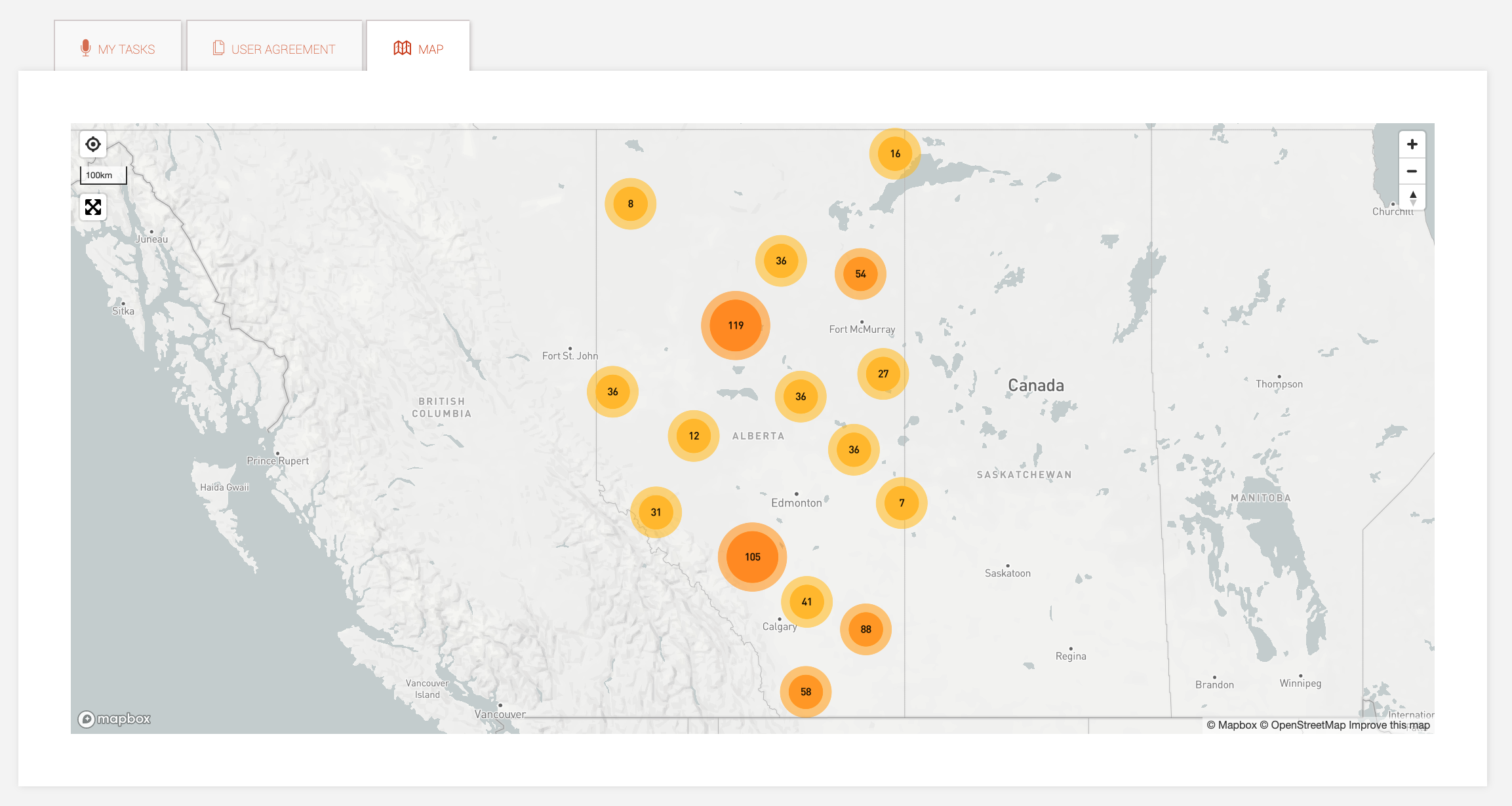
Project mapsThe Map displays all the locations in the project that contains spatial metadata. The visibility or buffer applied to the location will also be reflected in the map depending on your project or organization membership.
-
Validating data in the organization
When new media is uploaded into WildTrax, new locations will be generated in the organizations. Organization administrators and project administrators should work in tandem to ensure:
- Spatial coordinates (latitude and longitude) are entered for locations so that taggers and other users can see them on a map.
- Visit photos are uploaded to visits so that project taggers can see the habitat characteristics of the location when they're tagging using the Location Photos tab
- Running the visit autogenerator to check visit metadata against the media
- Ensuring faulty equipment is repaired from malfunctioning media