Index
2.2 Locations
Locations refer to the physical, geographic places at which environmental sensors were deployed and/or biological data was collected on the landscape. They are one of the most important components in WildTrax as media and metadata are linked by the location. Organizations control and manage access to locations.
-
Creating locations
Click the
 tab in your organization dashboard. Clicking
  will open the location form, where you can add the spatial metadata to the location or configure the location's settings. You only need to enter the location name, latitude and longitude in order to create a location.
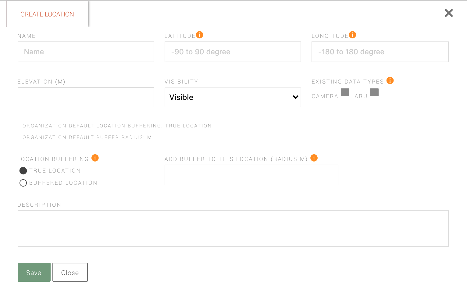
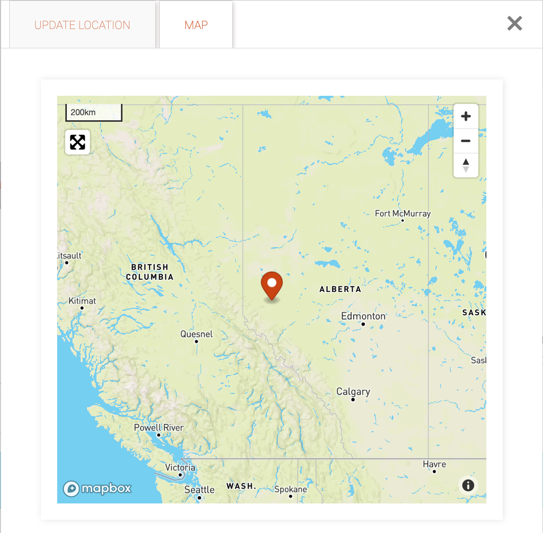
When you've filled in the form click
 . The map tab will appear allowing you to visualize the point on the landscape. The location will also be visible on maps across WildTrax.
Locations are created implicitly in the organization when media are uploaded to a project. If a location name already exists in the organization, WildTrax will append the media to it.
-
Configuring location settings
You can control each location's settings by clicking on the
 icon beside the location name. Location settings control who and what users can see across the system.
 - Location name: the prefix of the location
- Latitude: A 10-digit numeric value in decimal degrees (e.g. 54.67890918)
- Longitude: A 10-digit numeric value in decimal degrees (e.g. -115.0109191)
- Elevation: Elevation from sea level (meters)
- Visibility Toggle: Visibility option for the location
- Location Buffering: Buffering option for the location
- Buffer Size: Radius of the buffer (in meters)
- Description: A short description of the location. More details about the location can be added in the visit metadata.
-
Syncing locations
WildTrax also allows you to batch upload and download locations and location metadata by clicking the
 button. This allows you to manage and edit location information more flexibly outside of WildTrax and then sync it back with your modifications.
 You need to be an organization administrator in order upload data, however, as a read-only member, you can download data.
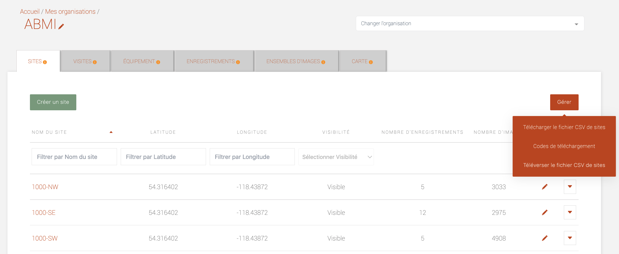
- Click the
 in order to get the current list of all locations and metadata in your organization. If you don't have any metadata yet, a template csv will be provided.
 - Conduct the edits or changes to your csv. You can modify entries that were downloaded, or
- Click on

- This will take you to the Upload CSV form; choose your local CSV file and click
 - this will allow you to preview the changes you’ll be making to your location data. If there are no differences, a prompt indicating
  will appear
 - To accept the modifications, scroll down and click

All batch upload processes to WildTrax work on add and update only. You cannot delete anything in batch, even if you are an administrator and accidentally uploaded an empty csv, for example.
- Click the
-
Merging locations
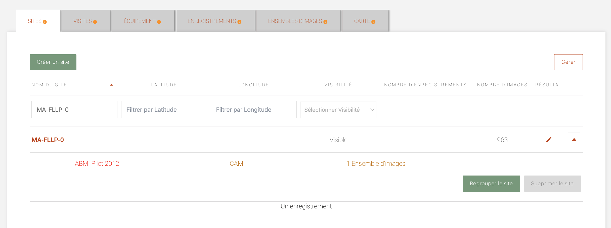
WildTrax allows you to merge multiple locations together. You may want to merge locations if the location has been visited multiple times but was named something different on each visit or if the locations are at the same place on the landscape.
- Select a location and click

- Click

- The location merge form will appear; ensure you are selecting the correct source location (location you want to change) and target location (location you are merging to) which you can choose from the dropdown list. The media will merge together but only the metadata from the target location is preserved.
- Click
 ; you should now see data for only the target location chosen in the previous step.
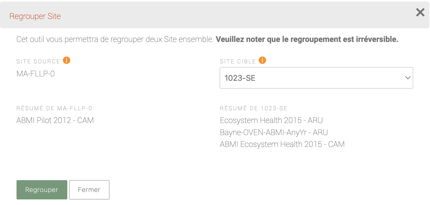
Only locations that have the same spatial coordinates can be merged. If a source or target location is missing spatial coordinates, WildTrax uses the exisitng entry during the merge. The merged location will also not generate spatial coordinates if a source and target location both did not contain any.
- Select a location and click
-
Deleting locations
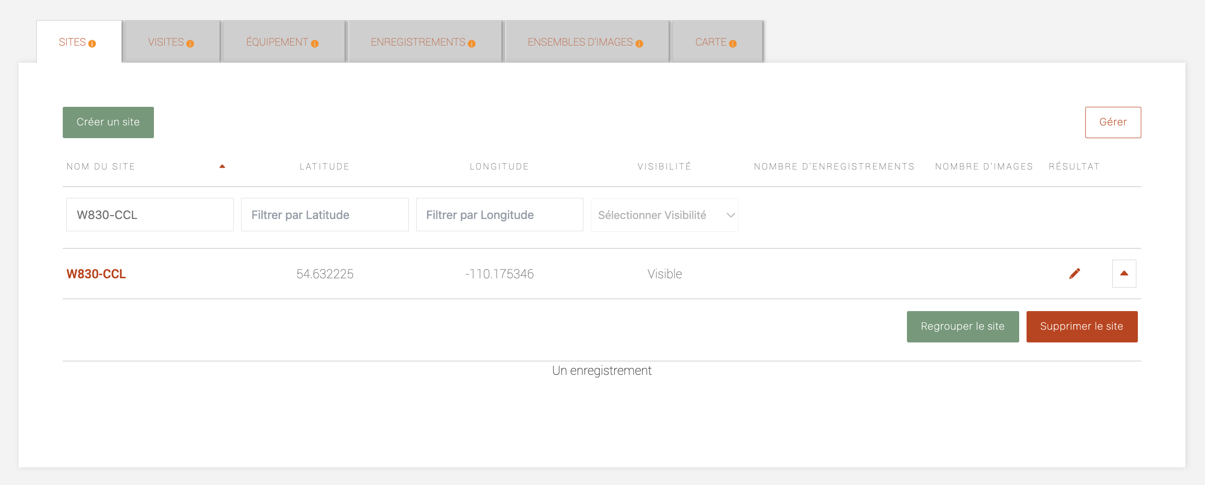
You can delete locations using the
 button located in the beside any location name. If any data (i.e. visits, media or tags) require a location to be supported, you will not be able to delete the location until these other data are removed first (button will appear grey like this:
  ). The sections on projects and the three sensor types (ARU, camera, point count) discuss how to do this more in depth. Given that locations support all cascading data beneath them, WildTrax has implemented these security measures to ensure that it is difficult to lose data.
WildTrax provides multiple ways for organization administators to control how WildTrax members can see locations and data collected at them. These location privacy options keep data protected when needed.
-
Location visibility
The location visibility setting is used to hide locations and data from WildTrax users who are not part of the organization or project the location belongs to.
- Use hidden - location if you want to hide only the location—only organization and project administrators will see the location in the maps across the system. Species data can still be downloaded by non-members but with no coordinates, non-members will not know where the data comes from.
- Use hidden - location + data if you want to hide both the location and the species information. This setting will effectively hide everything from users who are not organization or project members.
- Use visible if you want the location and data to be visible to everyone once the project is published
If you are using hidden - location + data, you can refer to location reporting to learn how to share data with users who are not members of the organization or project. This may include landowners, collaborators, or other users to whom you do not wish to grant privileges but are still able to share your data.
-
Location buffering
Location buffering is another way to mask sensitive locations. You can use the location buffering toggle in two ways:
- You can enter the true coordinates in the form and then instruct WildTrax to provide a buffer (indicated in the
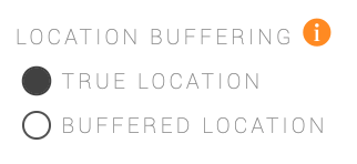 buffer size field)
 - You can enter previously buffered locations (done outside of WildTrax) and indicate the buffer radius you provided. This way WildTrax and other users will never know the true location.
- You can enter the true coordinates in the form and then instruct WildTrax to provide a buffer (indicated in the
-
Location reporting
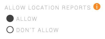
If you’re an organization administrator, you can allow public location reports independently for each location in the organization. This lets organization users share specific location reports with collaborators without having to give full project or organization access. This is particularly useful for organizations who need to provide reports to landowners, leaseholders, partners, and collaborators.
- Go to your organization’s settings and click on Allow in order to generate reports.
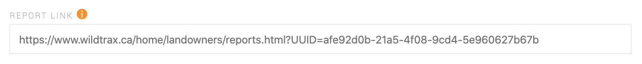
- Next, go to any location in your organization and scroll down to copy the report link. Open this in your browser or share it with the desired landowner or collaborator.
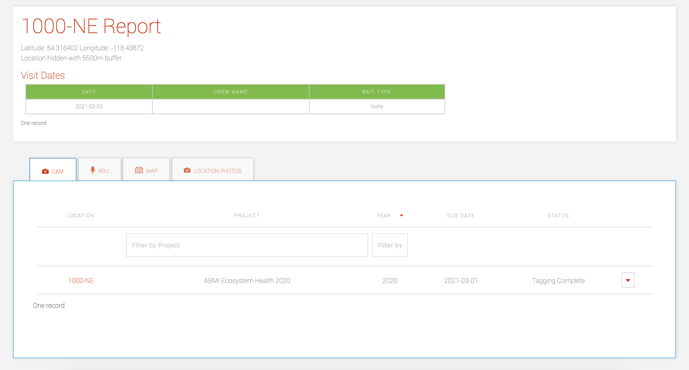
You can then easily access elements of the report by clicking on the different tabs depending on the sensors or data that were collected.
- Go to your organization’s settings and click on Allow in order to generate reports.
