Index
3.4 Point count projects
This section of the guide provides an overview to help you integrate your listening point data into WildTrax. The Boreal Avian Modeling Project offers services to help you adapt your data to this standard. Contact the Boreal Avian Modeling Project team for more information.
Setting up a point count project
To create a new project, click the  button in the project dashboard under the point tab. You must be the administrator of at least one organization within WildTrax in order to create a project. The main settings panel will have general information fields and a description of the project.
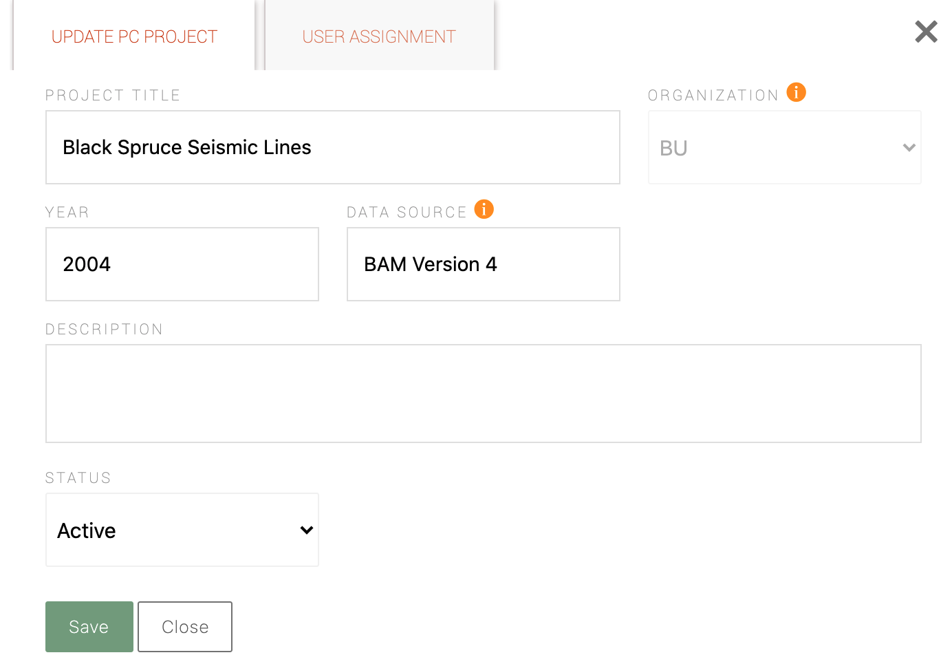
- Project Title: The full title defined by the user to identify the project.
- Organization: Drop-down list of all existing organizations of which you are an admin. This field allows you to group all of your projects together in the database. Once your project is saved you will be unable to change the organization to which it belongs.
- Year: The year the data was collected.
- Data Source: If you are importing data from an outside source (e.g. previously tagged data), please specify the original source of the data.
- Description: This field allows you to outline the purpose, goals, objectives, and methods of your project.
- Status: See more in publishing projects
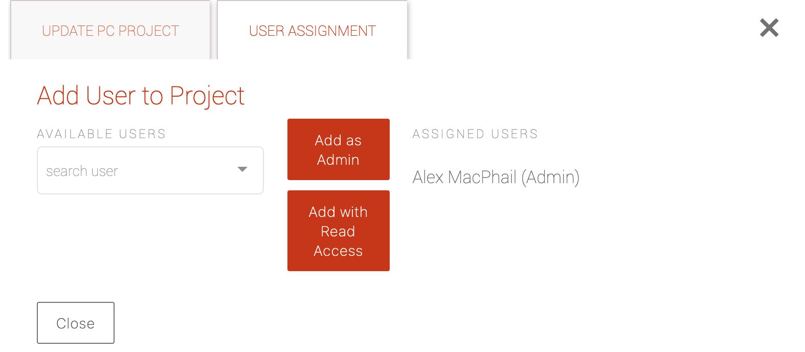
Once you save your project details, you will be able to manage your users. Select the  tab to add and view current administrator and read-only project members.
Uploading point count data
- Location: Name of the location
- Survey Date and Time: The date and time the survey took place (YYYY-MM-DD)
- Duration Method: The duration method is the unique combination of time intervals used for each individual survey. Each survey will have one to many time intervals (e.g. 0-10 or 0-3,3-5,5-10) with time measured in minutes. See more in point count data.
- Distance Method: The distance method is the single code assigned to a unique combination of distance bands. The number of bands can range from one to many (e.g. 0-50 or 0-50,50-100,100-150) and are measured in meters from the point count center where the observer stands. See more in point count data.
- Observer: The observer who conducted the survey.
- Species: The species of the observation; a four-letter WildTrax code modelled on the AOS system, english common name and latin names are all acceptable formats
- Distance band: The band the species was observed in. See more in point count data.
- Duration interval: The duration interval the species was observed in. See more in point count data.
- Abundance: The abundance of individuals in the observation
- Is seen?: Was the observation made visually?
- Is heard?: Was the observation made acoustically?
- Comments: Any important comments about the observation.
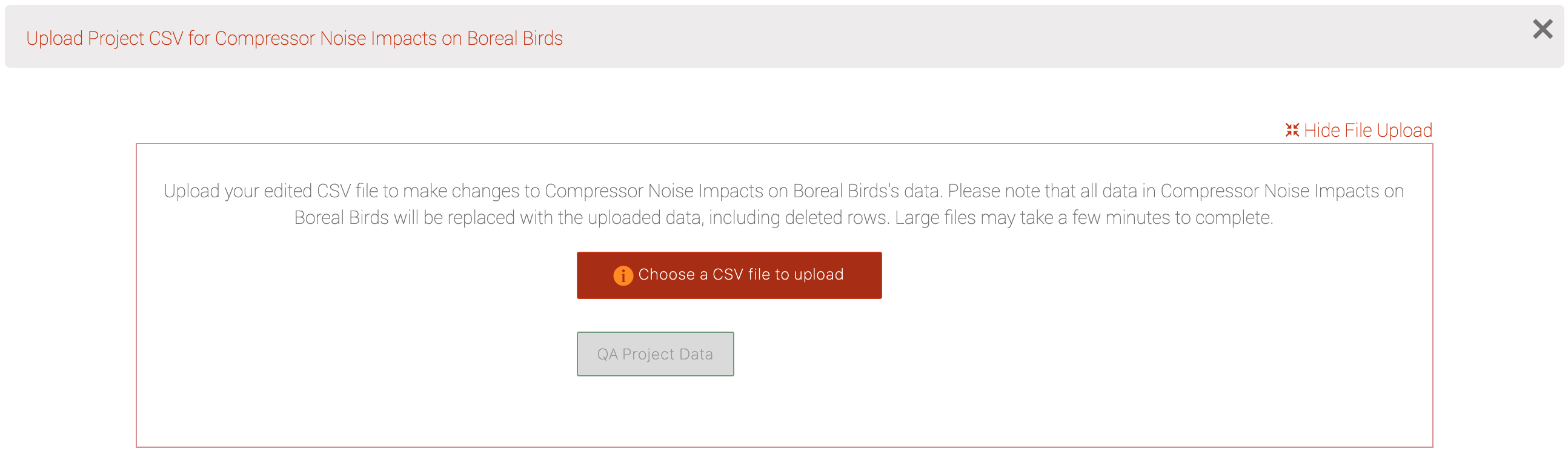
Click on the  button and select Upload Surveys. In the new pop-up window, select
  to select your survey data. When the file is uploaded the
  will turn green. Click it and WildTrax will ensure that the data you're uploading fits the WildTrax standard. This may take a few minutes depending how large your file is.
Just like with ARU and camera media upload, survey data will also implicitly create locations that don't yet exist in the organization. If the location exists, it will automatically join it to the spatial metadata provided the names match. You can merge locations if you need to later. Furthermore, since surveys only typically contain one visit, you can easily autogenerate them in the organization as well.